
The Old San Antonio Road in East Madison County
The Old San Antonio Road in East Madison County
- Map of the Old San Antonio Road in East Madison County
- Route Details
- Trinity River / Paso Tomas
- A Fork in the Road
- Midway
- State Highway OSR
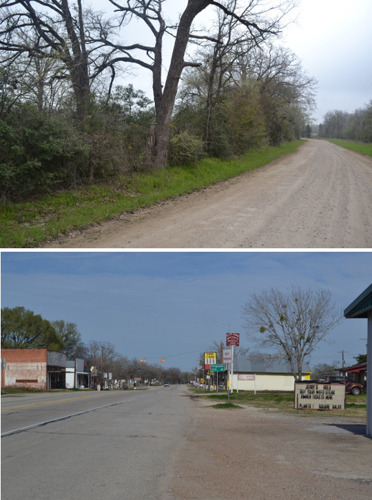
The Old San Antonio road runs through the northeastern corner of Madison County from the Trinity River to Interstate Highway 45. It enters the county on State Highway 21, but transitions to State Highway OSR near the town of Elwood. A geographical transition from east Texas to central Texas also occurs here.
Map of the Old San Antonio Road in East Madison County
[-]Collapse Map [+]Expand Map
Route Details
- From SH 21 at the Trinity River to SH OSR at FM 1119, the route of the Old San Antonio Road as plotted by V. N. Zively no longer exists on public roads. His route is loosely approximated by Highway 21 between the Trinity River and FM 242 and then by FM 242 from Highway 21 to FM 240.
- State Highway OSR from FM 1119 for 10.2 miles to Interstate Highway 45. SH OSR has two undivided lanes, with no shoulders. Except for one curve, this section of SH OSR follows the historic route exactly.
Bottom left: This clearing in the thick woods is what remains of El Camino Real as it approached Paso Tomas.
Bottom right: Historical marker for Trinidad.
Trinity River / Paso Tomas
The royal road's crossing of the Trinity River was given the name Paso Tomas in 1755 or 1756, after a Bidais native chief who the Spaniards called Chief Tomas. At this time, a road from Goliad - known at the time as La Bahia - converged with the road from San Antonio on the west bank of the river. After crossing the Trinity River, the road proceeded to Spain's missions at present-day Nacogdoches and San Augustine, then to the mission and presidio at Los Adaes in present-day Louisiana. While the Nacogdoches and San Augustine missions were lightly-manned and were little more than outposts, Los Adaes, the official capital of Spanish Texas, had a population of over 300. Paso Tomas, therefore, was an important gateway to Spain's interests in east Texas.
Bucareli, 1773-1778
In 1773, Spanish officials decided to close the presidio in Los Adaes and move all Spanish citizens in east Texas to San Antonio. Barely a week after their arrival, the disgruntled Adaeseños, under the leadership of Antonio Gil Ybarbo (also written as Y Barbo, Y'Barbo, YBarvo, or Ibarvo), petitioned the governor for permission to return to east Texas. They proposed establishing a new village at the site of the closed San Augustine mission. The governor responded with a compromise: the Adaeseños were allowed to leave San Antonio and establish their own new village, but it was to be at Paso Tomas on the Trinity River. So, in 1774, Ybarbo led his people to Paso Tomas and established the town of Nuestra Senora del Pilar de Bucareli.
Bucareli had a plaza, a stockade for cannons and guards, a chapel, and some houses. According to a 1777 report, there were 347 Spanish residents in the town. In May of that year, however, Comanches began making regular attacks on the settlement. The residents, who were already plagued by mosquitos and frequent flooding, endured these attacks for a year and a half before deciding to relocate to the old mission at Nacogdoches, which was not only further from the Comanche but also in the friendly company of Spain's Caddo allies, who were at peace with the Comanche. Ybarbo led the residents in their move to Nacogdoches first, and then obtained the governor's blessing afterward. No trace of Bucareli exists today, and its exact location is unknown.
Trinidad, 1806-1813
Spain returned to Paso Tomas in 1806, prompted by the United States' purchase of Louisiana from France. Santissima Trinidad de Salcedo was a military outpost that started out with some soldiers, plus a few dozen civilians to set up the beginnings of a town. At one time, Spain had 400 soldiers stationed at Trinidad as a defense against a possible U.S. invasion. After U.S. and Spanish military commanders signed the Neutral Ground agreement in November 1806, Spain reduced its military presence at Trinidad. This proved to be a miscalculation. In 1811, when revolutionary sentiment was in the air all across Mexico, the civilian population of Trinidad took over the town from the soldiers. The Gutiérrez-Magee filibustering expedition moved through Texas the following year and stayed in Trinidad for a month.
On August 18, 1813, the Spanish army under General Joaquín de Arredondo defeated the Gutiérrez-Magee republicans at the Battle of Medina in present-day Atascosa County. Following this decisive victory, Spanish forces marched up El Camino Real all the way to Nacogdoches, executing all who were considered to be revolutionaries. By the time they arrived at Trinidad, the town was already mostly depopulated. The Spanish commander burned the city. Its exact location is now unknown.
Robbins' Ferry, 1821-1930
The next settlers at Paso Tomas were Anglo-American. Joel Leaky established a ferry at Paso Tomas in about 1821. Nathaniel Robbins settled on the Trinity River in 1834 and took over the ferry. Robbins operated the ferry for 21 years, when it was taken over by his son-in-law, Elisha Clapp, in 1852. Clapp's descendants were still operating the ferry when the first bridge was constructed over the Trinity River in 1930.
Some county maps dated 1873 and 1896 show a community named Randolph at Robbins' Ferry.
Monuments and Markers
In 1915, Zively marked Robbins' Ferry on his survey of the Old San Antonio Road and placed a survey post there. The current bridge is about 500 feet upriver of Robbins' Ferry. The state now has a historical marker monument for Robbins' Ferry on the southwest bank of the river at Highway 21, about 0.2 miles from the bridge, but the Daughters of the American Revolution pink granite OSR marker that should be with it is instead 1.4 miles further southwest.
Records indicate that a state historical marker sign for Bucareli was placed in 1972 at the same coordinates as the Robbins' Ferry monument, but as of November 2013, that marker could not be found. There is a concrete base next to the Robbins' Ferry monument; in it is a small circular patch of concrete of a different color. This suggests that a sign used to be there, but the hole for the signpost was filled in.
A monument for Trinidad exists on Highway 21, three-quarters of a mile from the river.

Top right: Section of an 1851 Texas map drawn by Robert Creuzbaur.
Bottom: Section of an 1879 Madison County map produced by the Texas General Land Office.
A Fork in the Road
As noted in the previous section, eastern Madison County was at the intersection of two important early Texas highways. After El Camino Real crossed the Trinity River from east Texas, it forked. The main road to San Antonio turned to the west, toward present-day Normangee. The other fork, known as La Bahia Road, continued straight southwest to the town now known as Navasota, and proceeded from there to Goliad.
The majority of available maps from the 1830s and 1840s show the two roads forking very close to the Trinity River at Robbins' Ferry, but a few maps show one road leading southwest for a short distance, and the fork taking place further from the river. As maps became more detailed and accurate over time, they made it clear that the fork occurred some distance from the river. Compare the sections of the two Texas maps from 1851 in the top row of the exhibit at right. (At this time, the Old San Antonio Road was used as the boundary between Leon and Walker Counties.) The map on the right by Robert Creuzbaur, which is more detailed and accurate in every respect than the one at left,1 clearly shows the Old San Antonio Road dipping southwest for a short distance before breaking off to the west. According to this map, its separation from La Bahia Road took place between Robbins' Ferry and Young's Creek.
A detailed, well-preserved map of Madison County produced by the Texas General Land Office in 18792 attests to the accuracy of Creuzbaur's 1851 map. According to the 1879 map, the Old San Antonio Road and La Bahia Road forked about a mile from the river, approximately halfway between Robbins' Ferry and Young's Creek. This fork occurred approximately where State Highway 21 intersects County Road 245/Antioch Road. Other than the intersection being approximately in the same place, however, CR 245 does not show any resemblance to the Old San Antonio Road route as depicted on either of the 1851 maps, the 1879 map, or any other map.
V.N. Zively, who made his survey in 1915, followed La Bahia Road for 2.8 miles, all the way to Young's Creek, before turning to the west. From there, his route quickly catches up to the route shown on the 1879 map. Both Zively and the 1879 map have the Old San Antonio Road going straight east-to-west in approximately the same location of County Road 242/Burns Road. It is unclear whether Burns Road is a remnant of the Old San Antonio Road, or whether it simply happens to be in the same general area.
Bottom: Midway.
Midway
Midway was established in the 1850s. The origin of the town's name is unclear.3 It grew from 75 residents in 1884 to a peak of 530 in 1936. At that time, it had a bank, several schools and churches, and other businesses.
In 1929, the Texas Legislature passed a law requiring the state highway commission to preserve and maintain the Old San Antonio Road route surveyed by Zively in 1915. A new highway called Texas State Highway OSR was built to preserve a section of Zively's route where no state highway yet existed - between Midway and San Marcos. A map produced by the Texas Highway Commission in 1933 shows Highway OSR mostly under construction from Midway to Benchley. The only section open at that time was between Highway 75 and Normangee. A 1936 map shows the highway completed from Midway to Benchley.
While this law was a major step in preserving Zively's route, its enactment fell short in many areas, one of which was that the origin of the new road was placed in Midway. As explained in the above section, "A Fork in the Road," the historic Old San Antonio Road as depicted on mid-19th-century maps forked off of present-day Highway 21 no more than a mile from the Trinity River. The route Zively surveyed forked further southwest, close to County Road 242 at Young's Creek. Instead of following either of these routes, however, Texas State Highway OSR was built to intersect with Highway 21 on the south side of Midway, nearly two miles distant from Zively's route and nearly four miles from the historic route. Highway OSR does not accurately preserve the Old San Antonio Road until its intersection with Farm-to-Market Road 1119 near Elwood.
Some modern web-based resources about El Camino Real - and, doubtless, some in print as well - depict the current route of Highway OSR in Midway as historically accurate. Every map this author has seen from 1879 and earlier contradicts this depiction, as does Zively.
Zively placed a survey post for OSR Marker #34 along the section that is approximated today by Burns Road. On his survey notes, he stated that the post was placed "On the John Crist League about 2 miles N10W from Midway." The marker has since been moved to Midway.
Midway has declined since is 1936 peak. It now has 228 people and three businesses. The town looks very much alive today, but most of the buildings look old.
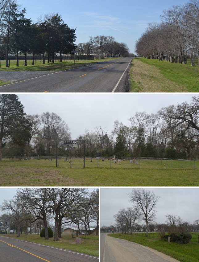
Middle: Elwood Cemetery at FM 1119 and CR 232/Gin Rd.
Bottom (l to r): OSR Marker #35 at Elwood Baptist Church; OSR Marker #36 at State Highway 75.
State Highway OSR
About a thousand feet west of FM 1119, State Highway OSR merges with Zively's surveyed route of the Old San Antonio Road. It runs northwest through the community of Elwood.
Elwood, said to be named for the abundant elm trees in the area, was settled beginning in the 1830s. By 1852, when a post office was established, the community had a general store and a Methodist church. The town continued to grow even after the post office was closed in 1860. A school was added to the church in 1874. Cobbs Creek Baptist Church was founded in 1899, when the town had a population of about 250. A second post office was also opened in 1899, but it closed in 1905. The town was located along present-day State Highway OSR, FM Road 1119, and County Road 232/Gin Road.
Zively does not show a town called Elwood on his survey or mention it in his notes, but he does show "Cobbs Creek Town" where Cobb Creek crosses the highway about a mile northwest of Elwood. There is no other mention of a Cobbs Creek Town in Madison County history, and a visit to the site he marked today will confirm that a town did not exist there a century ago. Apparently, he was referring to Elwood and assumed the name of the town from either the creek or Cobbs Creek Baptist Church. Regardless, he described the town as "a neat, thrifty village." Today, the businesses are gone, but Elwood's modern homes, mowed yards, and cleared, well-maintained fence lines certainly evoke the impression of "a neat, thrifty village" to this day.
Zively placed a survey marker near Elwood, but due to questions about his accuracy and terminology, it is difficult to know for sure where he left it. OSR Marker #35 has been next to Elwood Baptist Church for at least several decades.
State Highway OSR follows Zively's route precisely between Elwood and Interstate Highway 45. OSR Marker #36 is on this section, west of State Highway 75.
Page last updated: April 24, 2014
1Compare both maps' outlines of the Trinity River, for example, with the Google map at the top of this page.
2Madison County was created in 1853.
3A theory that attributes the name to Joseph Addison Clark's hometown in Kentucky is not supported by Clark's biography.
- Zively, V.N. - "Field Notes and Detail Map of the Kings Highway", 1916
- Carson, David - field notes observed and recorded in 2014
- Texas State Historical Association - The Handbook of Texas Online
- University of Texas at Austin - Texas Beyond History