
The Old San Antonio Road on the Brazos-Robertson County Line
The Old San Antonio Road on the Brazos-Robertson County Line
- Map of the Old San Antonio Road on the Brazos-Robertson County Line
- Route Details
- Navasota River
- State Highway OSR
The Old San Antonio Road has been used as a county line since the founding of the Republic of Texas. The section on this map was set as the boundary between Robertson and Washington Counties in 1836 and has been unchanged since then. This is a rural area with no towns. The country is used for cattle farming and for oil and gas production.
Map of the Old San Antonio Road on the Brazos-Robertson County Line
[-]Collapse Map [+]Expand Map
Route Details
- SH OSR from the Navasota River for 21.3 miles to SH 6. For the first 1.7 miles, SH OSR approximates Zively's route. From a half mile east of FM 1940 for the next 19.6 miles, it follows Zively's route exactly. SH OSR has two undivided lanes with no shoulders. It is in subpar condition within a few miles of SH 6.
Bottom: Site of OSR Marker #41.
Navasota River
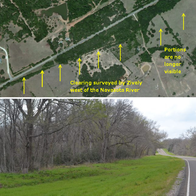
The Old San Antonio Road's intersection of the Navasota River forms the common corner of four counties: Leon, Madison, Brazos, and Robertson. The county lines here have not changed since 1846. This means that both the course of the river and the path of the road have been fixed for at least that long. When V.N. Zively conducted his survey of the OSR in 1915, however, he followed a different, evidently older route that angled to the south after crossing the river. About 0.7 miles west of the river, Zively's route was about 500 feet inside Brazos County. It then angled back toward the county line, merging with it about 0.5 miles east of Farm-to-Market Road 1940. Part of Zively's route is very evident today in satellite photos as a clearing in the trees, and is now used as a utility easement. The rest of Zively's route has been erased.
OSR Marker #41 is 0.4 miles west of the Navasota River. It is on a section of SH OSR that does not match Zively's route, but is accurate to within a few hundred feet.
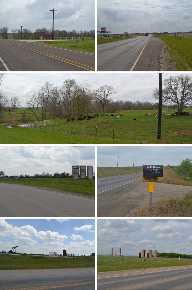
Second row: Cow pasture east of Little Cedar Creek.
Third row (l to r): Site of OSR Marker #44, mailbox belonging to one of James and Isabella Dunn's descendants.
Bottom (l to r): Oil field west of Wheelock; site of OSR Marker #45.
State Highway OSR
Zively's route merges with Highway OSR a half mile east of FM 1940. Zively's route, Highway OSR, and the Brazos-Robertson County line are one and the same for the next 19.6 miles until Highway 6. According to maps produced by the Texas Highway Department, this part of Highway OSR was paved between 1933 and 1936.
The first feature Zively noted west of the Navasota River is Little Cedar Creek, where he placed the survey post for OSR Marker #42.
Further down the road, west of Little Cedar Creek, is Big Cedar Creek. At 0.6 miles east of Big Cedar Creek, Zively noted the "Road to Whelock," or Cedar Creek Road. The town of Wheelock is about 2¾ miles west on Cedar Creek Road, or 2 miles north along the much straighter FM 46. Zively placed the survey post for OSR Marker #43 where FM 46 intersects Highway OSR.
Founded in 1834, Wheelock became one of the most prosperous and well-known towns in central Texas in the 1830s and 1840s. It declined almost out of existence in the latter half of the 19th century, especially after the Houston & Texas Central railroad bypassed it in 1868, but it partially rebounded in the 20th century. It had 225 people in 2000.
The area southwest of Wheelock was settled by James and Isabella Dunn, who were part of a group of Irish settlers who arrived in Robertson County in 1833.1 A grave on their homestead where they buried their infant child became a local cemetery. The Dunn home, also known as Dunn's Fort, served as a defensive position against raiding Indians. A road to the original Dunn home site, where the cemetery still exists, is called Dunns Fort Road, and is found halfway between OSR Marker #43 and OSR Marker #44. Zively indicated the intersection of the Old San Antonio Road and Dunns Fort Road with the drawing of a house labeled "Geo. Dunn's Home." The area is still occupied by the Dunn's descendants.
The majority of the Irish settlers who arrived with the Dunns in 1833 settled further southwest in a community they named Staggers Point. The word "stagger" is said to be synonymous in the settlers' dialect with "striver," as in "one who is determined to succeed." According to a state historical marker at the site of OSR Marker #45, Staggers Point was "about a mile north" of the marker. It might have been on Campbells Creek or Walker Creek.
Staggers Point, the first town in Robertson County, had a wild reputation for drinking, gambling, gunfighting, and con men. In 1868, the Houston & Central Texas Railroad went through Robertson County about two miles to the west of Staggers Point. Staggers Point relocated and became the town of Benchley. Benchley had about 100 to 150 residents when Zively passed by in 1915. Its population has been reported as 110 since 1968.
Page last updated: May 19, 2014
1Mr. Dunn's first name is sometimes given as George, and his year of arrival is sometimes given as 1832.
- Zively, V.N. - "Field Notes and Detail Map of the Kings Highway", 1916
- Carson, David - field notes observed and recorded in 2014
- Texas State Historical Association - The Handbook of Texas Online