
The Old San Antonio Road Posts and Markers in West Nacogdoches County
The Old San Antonio Road Posts and Markers in West Nacogdoches County
- Map of the Old San Antonio Road in West Nacogdoches County
- Marker #14
- Marker #15
- Marker #16
- Marker #17
- Marker #18
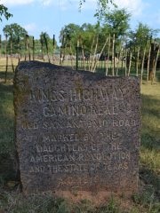
Zively placed nine oak survey posts in Nacogdoches County. This page covers the five on the western half of the route through the county: two in Nacogdoches and three between Nacogdoches and the Angelina River. All five have been located and are at their survey post locations. All of them are publicly accessible, but at least two are on private residential easements, so discretion is advised when visiting them.
Map of the Old San Antonio Road in West Nacogdoches County
[-]Collapse Map [+]Expand Map
|
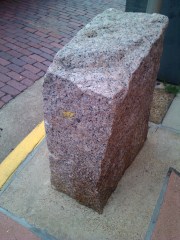
Marker #: 14
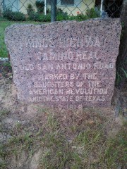
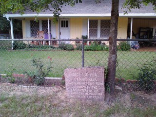
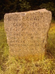
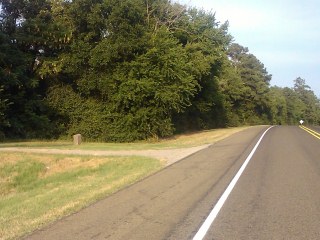
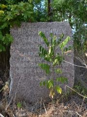
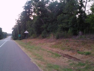
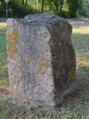
Coordinates: 31.59971, -94.61390 Location: East side of Nacogdoches Relation to Road: 32 ft from north stripe, facing road, SW 180° Distance from post: At post Dimensions: 24" x 26" x 13" Setting: Dirt/grass Other Markers/Signage: No Visibility: Medium Accessibility: Good This marker is in front of a house at 3821 Upper Melrose Road, 0.3 miles east of the intersection with State Highway 7. The marker is in front of the fence on the property, apparently in the utility easement. There is street parking very close by. Visitors are urged to remember that even though the marker appears to be on an easement, it is still on or directly adjacent to someone's home, so discretion and respect should be shown. The resident of the house permitted our visit. The marker rests deep in the soil. It has never been moved, but a large portion of the back is missing. Observed on August 10, 2013. |
|
|
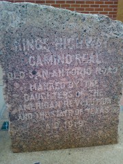
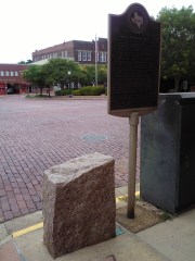
Marker #: 15
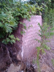
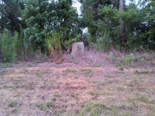
Coordinates: 31.60285, -94.65449 Location: Downtown Nacogdoches Relation to Road: 16 inches from north curb, facing road, SW 220° Distance from post: At post Dimensions: 31" x 26" x 13" Setting: Concrete Other Markers/Signage: Yes Visibility: Medium Accessibility: Excellent This marker is at the northwest intersection of Main Street (S.H 21/7) and North Fredonia Street in downtown Nacogdoches. It is in front of a red brick building currently occupied by Commercial Bank of Texas. This building is on the site of the Old Stone Fort, a prominent building from 18th and 19th-century Nacogdoches. There is a historical marker next to the granite marker, and a plaque for the Old Stone Fort on the wall behind the marker. Despite being out in the open, the marker is in a busy area and blends in to its surroundings; it could easily be missed unless one is looking for it or accidentally walks into it. There is public street parking a block to the east. The marker has splotches of yellow paint, the same color as the street curb, on either side. Its top slopes prominently from left to right. This marker is at its original location. Observed on August 10, 2013. |

|
|
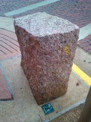
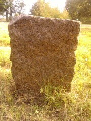
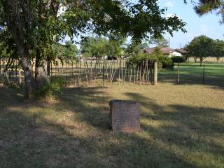
Marker #: 16
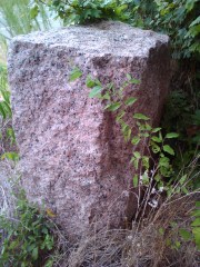
Coordinates: 31.626144, -94.731591 Location: SH 21 west of Nacogdoches Relation to Road: 41 ft from north stripe, facing road, SW 270° Distance from post: At post Dimensions: 30" x 27" x 14" Setting: Grass Other Markers/Signage: No Visibility: Medium Accessibility: Medium This marker is 3.0 miles west of US 59/Loop 224 in Nacogdoches and 0.1 mile east of County Road 823. It is next to a residential driveway. It is in a mowed clearing off of a paved shoulder. The marker is not easily spotted when driving from Nacogdoches, but it is easily spotted from the west. The marker is significantly wider at the top than at the base; the 27" width measurement given above was taken at the top. This marker appears to be at its original location. Nevertheless, the Texas DAR did not find it in its 1995-2001 rededication project. The coordinates given for it on the El Camino Real National Historic Trail Association's interactive map in 2013 were correct. Observed on August 10, 2013. |
|
|
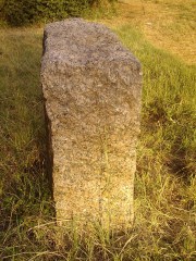
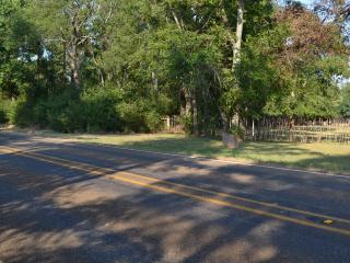
Marker #: 17
Coordinates: 31.658169, -94.801413 Location: SH 21, 5 miles east of Douglass Relation to Road: 42 ft from north stripe, uphill, facing road, S 180° Distance from post: At post Dimensions: 32" x 25" x 17" Setting: Grass Other Markers/Signage: No Visibility: Low Accessibility: Fair This marker is 0.1 miles east of County Road 841. It is directly north of the north end of Lake Nacogdoches, between branches of the Bayou Loco. It is on the brush line at the top of a ridge. The brush semi-envelopes the marker. It is impossible to spot from the west, and difficult to spot from the east. There is a paved shoulder, so parking is not a problem. The climb up and down the short but steep ridge may be prohibitive for less-mobile visitors. This marker appears to be at its original location. Nevertheless, the Texas DAR did not locate it in its 1995-2001 rededication project. The coordinates given for it on the El Camino Real National Historic Trail Association's interactive map in 2013 were correct. Observed on August 31, 2013. |
|
|
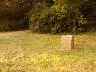
Marker #: 18
Coordinates: 31.67326, -94.87796 Location: FM 225 at SH 21 north of Douglass Relation to Road: 20 ft from east stripe, facing road, W 260° Distance from post: 0.5 mi, on route Dimensions: 26" x 26" x 16" Setting: Grass Other Markers/Signage: No Visibility: Medium Accessibility: Good This marker is on FM 225, 0.4 miles north of Highway 21, north of the town of Douglass. It is on an easement of mowed grass, in the shade of some large trees in front of a farm. This is a residential street. There is a shallow drainage ditch instead of a shoulder on the marker (east) side of the street, but the grass shoulder on the west side, opposite the marker, is suitable for parking. Today, Highway 21 curves to the south to serve the town of Douglass, but when Zively surveyed the Old San Antonio Road, it passed by Douglass to the north, where this marker is. While pinpointing the location of Zively's survey post is always harder where his road no longer exists, it was probably about a half mile west of FM 225. It seems that whoever moved the marker paid attention to keeping it on Zively's surveyed route, in the closest publicly-accessible place possible. The marker would have originally faced south, but in order to face FM 225, it has been reoriented to face west. With only 24 inches of it sticking above ground, it is buried quite deep, suggesting it was moved long ago. Observed on August 31, 2013. |
|
- Zively, V.N. - "Field Notes and Detail Map of the Kings Highway", 1916
- Carson, David - field notes observed and recorded in 2013.
- Texas Society of the DAR - Old San Antonio Road DAR Marker Information Site
- El Camino Real de los Tejas National Historic Trail Association