
The Old San Antonio Road Posts and Markers in Cherokee County
The Old San Antonio Road Posts and Markers in Cherokee County
Also see The Old San Antonio Road in Cherokee CountyZively placed four oak survey posts in Cherokee County. The corresponding marker on the Angelina River has long been lost. The other three markers are at or near their original locations on Zively's route.
Map of the Old San Antonio Road in Cherokee County
[-]Collapse Map [+]Expand Map
|
Marker #: 19
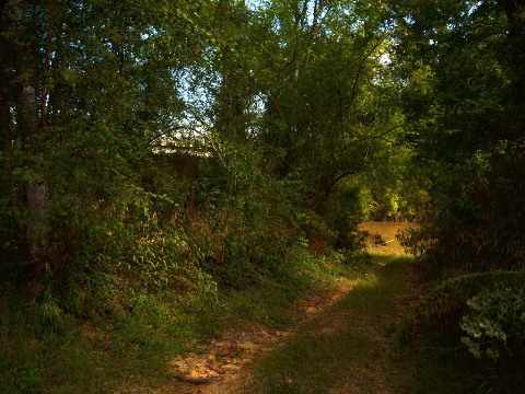
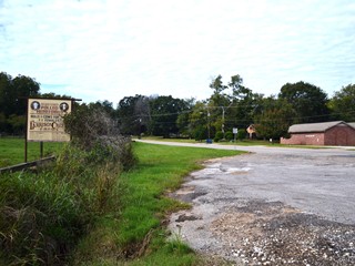
Coordinates: N/A Location: Not found Finding the original placement of this missing marker is difficult - perhaps impossible - because of changes in the course of the Angelina River. When Cherokee County was created in 1846, the Angelina River was used as the boundary between it and Nacogdoches County. The river has moved considerably east over time, however. The current Highway 21 river crossing is 0.3 miles east of the original crossing. The county line has not moved, so a section of Nacogdoches County is now on the west side of the Angelina River. Oxbow-shaped remnants of the river that describe the county line still exist and are clearly visible on aerial photos and most modern maps. According to Zively's 1915 sketch, the marker was placed at Linwood Crossing on the west side of the river, which Zively also showed as the county line. Maps from the early 1900s indicate, however, that the river had already moved east by then, possibly as a result of a major flood in May 1908. Zively's sketch of the river does not correspond to either the original course, its course as depicted on contemporary maps, or its present course. Without knowledge of where the river was when Zively made his survey, we cannot know where he placed his survey post. Adding to the difficulty of finding the marker's original location is the fact that the bridges and road have moved. The current structures were completed in 1955. Remnants of an earlier bridge over the "old river" still exist south of the present bridge. A dirt trail also still exists, running south of and parallel to Highway 21 from the entrance to Linwood Crossing up to the "new river." OSR Marker 19 was presumably placed north of this road, but south of the present road. The granite marker has never been found. In 2013, the owner of the property at Linwood Crossing, who was born in 1936 and had lived there her whole life, said that she had never seen it. In all likelihood, the earth surrounding the marker was washed out in a flood. The marker is probably buried under a layer of mud somewhere in or near the river bed, some unknown distance downstream from where it was placed. Observed on September 30, 2013. |
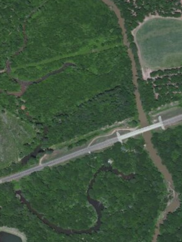
Above: Aerial photo of the Angelina River at SH 21. The oxbow lakes on the left indicate the river's course when the county line was set. The river now follows a much straighter and more easterly course, as seen on the right side of the photo.
Below: Old Angelina River crossing, just south of the Highway 21 bridge.
|
|
Marker #: 20
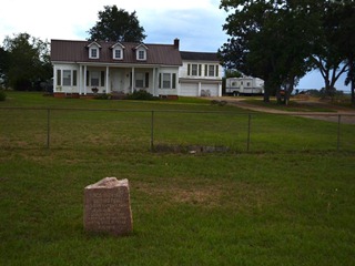
Coordinates: 31.654495, -95.038107 Location: East of Alto Relation to Road: 26 ft from south stripe, facing road, N 340° Distance from post: 0.1 mi from post, on route Dimensions: 33" x 25" x 15" Setting: Grass Other Markers/Signage: No Visibility: Medium Accessibility: Good This marker is on Highway 21, 2.1 miles east of U.S. Highway 69 in Alto. It is 0.1 mile east of County Road 2604 and 0.3 miles west of County Road 2610. It is in front of the house at 9650 Highway 21, on the south side of the highway. It is in a flat lawn of mowed grass. Parking on the grass should be no trouble, even in wet weather. The marker has a very irregularly-shaped top. The presence of the characteristic divot on the front center top suggests that despite how it looks, the top of the marker has not been damaged; rather, it was manufactured that way. All OSR markers were originally surveyed and placed on the north side of the Kings Highway. This marker is in the correct location, except that it is on the wrong side of the road. The highway has not moved, and the marker's north-facing orientation proves that it has been moved, or at least turned, since it was originally placed. It looks like it was deliberately relocated to be in front of this house. Observed on September 30, 2013. |
|
|
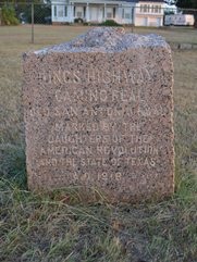
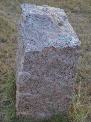
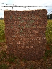
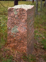
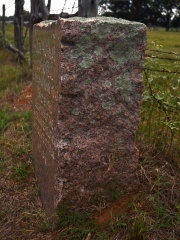
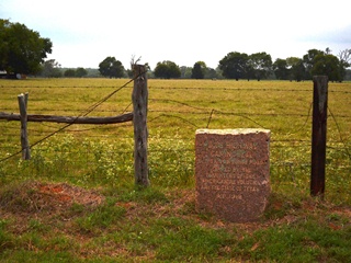
Marker #: 21
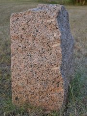
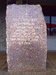
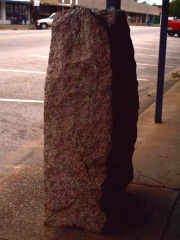
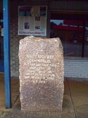
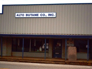
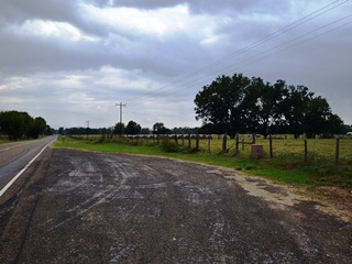
Coordinates: 31.650664, -95.073025 Location: In downtown Alto Relation to Road: 2 ft from north curb, facing road, SW 270° Distance from post: At post Dimensions: 54" x 32" x 17" Setting: Concrete Other Markers/Signage: Yes Visibility: High Accessibility: Excellent This marker is at the intersection of SH 21 and U.S. 69 in Alto, in front of the Alto Butane Company. There is parking on the street in front and in a side lot a few steps away. This marker is at its original survey post location, but it had previously been located 0.7 miles east on SH 21, across the street from the O.T. Allen Funeral Home. It was moved here, to its original location, in 1991 during the state's observance of El Camino Real's tricentennial. An El Camino Real informational display was also placed on the wall behind the marker. This marker is notable for its size. It stands 54 inches above the ground, making it one of the two tallest OSR markers in existence. Its height is enhanced by the fact that it is set in only a few inches of concrete, whereas most OSR markers are sunk a foot or more into the ground. Note how, in the photo at right, the lower portion, which had been buried until 1991, is much less weathered than the upper portion. Even without that advantage, however, the stone itself is still easily a foot taller than most of the others. Additionally, its width of 32 and depth of 17 inches are both above-average. If we assume that there are another six inches of the marker in the ground, and use a density of 1.555 ounces per cubic inch, then this marker's weight is calculated at 3,172 pounds. Observed on September 30, 2013. |
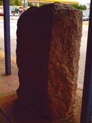 
Below: Marker 21's location prior to 1991.
 |
|
Marker #: 22
Coordinates: 31.604941, -95.139407 Location: Highway 21, east of the Caddo Mounds Relation to Road: 38 ft from north stripe, facing road, SE 130° Distance from post: 0.3 mi west, on route Dimensions: 32" x 26" x 13" Setting: Dirt/grass Other Markers/Signage: No Visibility: High Accessibility: Excellent This marker is 5.0 miles southwest of Alto on SH 21, and 1.0 miles northeast of the prehistoric Caddo Mounds. It is 1.0 miles west of CR 2905 and 0.2 miles east of CR 2807. Though there are no signs, it is easy to find because of the large highway pulloff in front of it. This marker is about 0.3 miles west of the survey post location. Zively's survey shows a zig-zag in the Old San Antonio Road here, whereas Highway 21 passes straight through. The marker may have been moved when the road was straightened. The surfaces of this marker are spotted with lichens. Observed on September 30, 2013. |
|
- Zively, V.N. - "Field Notes and Detail Map of the Kings Highway", 1916
- Carson, David - field notes observed and recorded in 2013.
- Carson, David - Interviews with Cherokee County Judge Chris Davis on August 31, 2013 and September 30, 2013.