
The Old San Antonio Road Posts and Markers in Central Houston County
The Old San Antonio Road Posts and Markers in Central Houston County
Also see The Old San Antonio Road in Central Houston CountyZively placed ten oak survey posts in Houston County, three of which were in the central part of the county shown on this map. Two of the matching granite markers are at their original locations on present-day Highway 21. The other one has been moved to Highway 21 and is no longer on the Old San Antonio Road.
Map of the Old San Antonio Road in Central Houston County
[-]Collapse Map [+]Expand Map
|
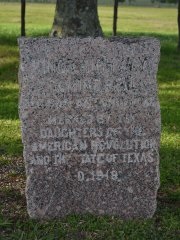
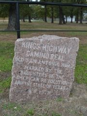
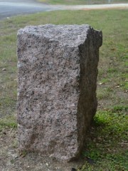
Marker #: 27
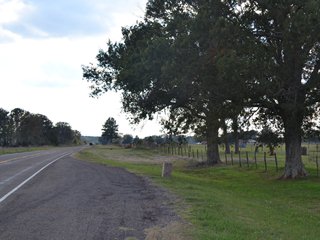
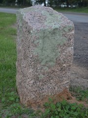
Coordinates: 31.376477, -95.373935 Location: SH 21, 7 miles northeast of Crockett Relation to Road: 21 ft from north stripe, facing road, SE 130° Distance from post: At post Dimensions: 31" x 21" x 17" Setting: Dirt/grass Other Markers/Signage: Yes Visibility: High Accessibility: Excellent This marker is in the countryside between Crockett and the Davy Crockett National Forest. It is 1.4 miles east of County Road 1515 and 2.6 miles west of CR 1535. It is in a mowed clearing at a highway pulloff under two large shade trees. The pulloff is well-marked with historical marker signs on the highway, even though the OSR Marker is the only object at the site.1 The only thing physically distinctive about this marker is its thickness. At 17 inches deep, it is significantly more massive than the average OSR marker. This marker is at its original location. Observed on October 26, 2013. |
|
|
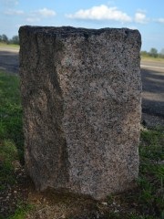
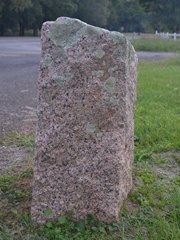
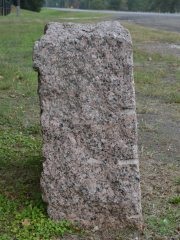
Marker #: 28
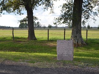
Coordinates: 31.314600, -95.419851 Location: SH 21 northeast of Crockett city limits Relation to Road: 31 ft from north stripe, facing road, S 160° Distance from post: 1.5 mi north of post, off route Dimensions: 32" x 30" x 14" Setting: Dirt/grass Other Markers/Signage: Yes Visibility: High Accessibility: Excellent This marker can be found at the intersection of Highway 21 and County Road 1500, which is outside the State Highway 304 loop around Crockett. It is in a clearing at a highway pulloff that is marked with historical marker signs. The OSR marker is the only object at the site. The top of the marker slopes down from right to left. The surface of the marker is splotched with lichens. This marker is not on the Old San Antonio Road. The Kings Highway departed from Highway 21 at CR 3187 and curved around the east and south sides of Crockett. Zively noted that he placed the survey post where "Crockett and Kinnard Road" - today's State Highway 7 - intersected a creek named "Grannie's Branch". Based on his sketch and notes, this creek must be Arnold Creek. He shows that he placed the survey marker on the east bank of the creek. It is now approximately 1.5 miles north of this position. It serves no purpose to have this marker on Highway 21, where it misinforms the public and visitors about the route of the Old San Antonio Road. The marker would be just as accessible to the public if it were moved back to its original location on Highway 7 at Arnold Creek. Observed on October 26, 2013. |
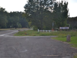
Below: Marker #28's original location, Arnold Creek at Highway 7.
|
|
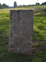
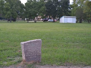
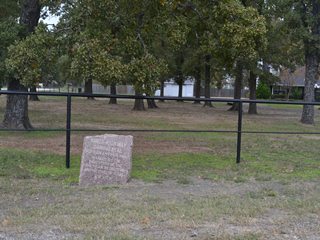
Marker #: 29
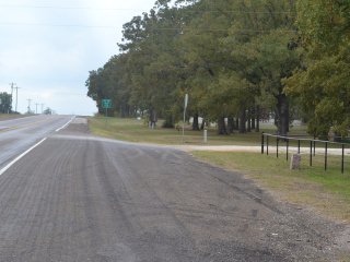
Coordinates: 31.296459, -95.496690 Location: SH 21 southwest of Crockett Relation to Road: 34 ft from northwest stripe, facing road, SE 130° Distance from post: At post Dimensions: 26" x 25" x 12" Setting: Dirt/Grass Other Markers/Signage: Yes Visibility: High Accessibility: Excellent This marker is in a residential area on the outskirts of Crockett, at the intersection of Highway 21 and County Road 3015.2 It is at a highway pulloff. There are historical marker signs on Highway 21 a mile in each direction from the marker, but there is not a sign directly across the street. The top of the marker slopes from right to left, but the marker has also sunk to the right, with the end result that the top of the marker is parallel to the ground. The right side of the marker appears to be more sunken today than it was when the Daughters of the American Revolution documented it between 1995 and 2001. This marker is at or near its original location. Observed on November 16, 2013. |
|
1Elsewhere in Texas, outside of Houston County, historical marker signs are not usually placed for OSR markers by themselves; they only have such signs when other historical markers are present with them.
2As of November 17, 2013, County Road 3015 was designated incorrectly on the Google Maps application used on this page. If you are planning to visit this marker, please consult multiple map or GPS sources to avoid being misdirected.
- Zively, V.N. - "Field Notes and Detail Map of the Kings Highway", 1916
- Carson, David - field notes observed and recorded in 2013.