
The Old San Antonio Road Posts and Markers in North Caldwell County
The Old San Antonio Road Posts and Markers in North Caldwell and County
Also see The Old San Antonio Road in North Caldwell CountyZively placed six oak survey posts in Caldwell County and along its boundary with Hays County. Two of them were in the northern part of Caldwell County shown on this map. One has not been found. The other one has been moved, but is still on Zively's route.
Map of the Old San Antonio Road in North Caldwell County
[-]Collapse Map [+]Expand Map
|
Marker #: 69
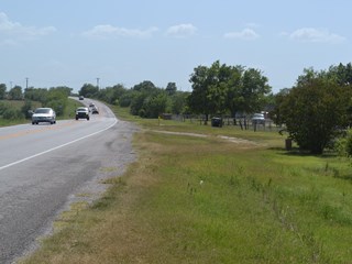
Coordinates: N/A Location: Not found Zively placed his 69th OSR survey post at the Bastrop-Caldwell County line. Highway 21 accurately preserves Zively's route at this location, but the granite marker has not been found. Observed on August 2, 2014. |
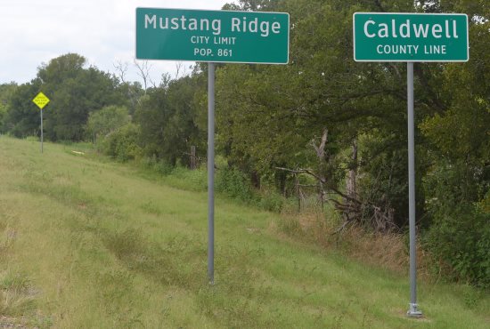
Above: Survey post #69 location. The signs in the foreground are in Bastrop County; the Bastrop-Caldwell county line actually crosses the highway approximately at the yellow school bus stop sign in the background of the photo. OSR Marker #69 would have originally been placed near that sign.
|
|
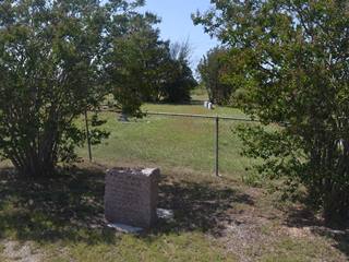
Marker #: 70
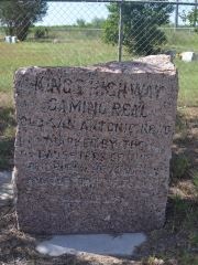
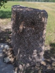
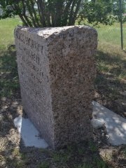
Coordinates: 30.023080, -97.707887 Location: SH 21 at the Niederwald Cemetery Relation to Road: 35 feet from north stripe, facing road, S 160° Distance from post: 0.3 miles west of post, on route Dimensions: 28" x 25" x 12" Setting: Concrete Other Markers/Signage: No Visibility: Medium Accessibility: Very Good This marker is in front of the Niederwald Cemetery in Caldwell County, 1.1 miles west of State Highway 130/US Highway 183. Some county line signs for Caldwell and Hays counties are a few yards away.1 The marker is in a lawn of mowed grass in front of the cemetery fence. It is planted between two crepe myrtle trees, which reduce visibility from the highway. There is a basic but adequate pulloff consisting of tracks in the grass where gravel and asphalt road material are mixed into the earth. The marker and the concrete base lean forward, apparently having shifted since the concrete was poured. The marker is lightly coated with tree residue. The engraving is crooked in relation to the marker's face. A black, powdery substance applied to the lettering some time ago, to make the engraving easier to read, has largely eroded away. It is impossible to tell from Zively's survey where this marker was originally placed. He noted that he placed the oak survey post on the northeast corner of the intersection of the Kings Highway and the "Austin and Lockhart Road." Both the current State Highway 130/US Highway 183, which has been in use since at least the 1920s, and the county road now known as "Old Lockhart Road" are too far east to be at the location that Zively indicated on his survey. He could have possibly have been referring to the road now called Williamson Road, but even then, his distances between various points of reference don't add up. On our map, we have placed the survey post for Marker #70 about 0.3 miles east of the granite marker's present location, but this is only an educated guess. Highway 21 is now slightly south of Zively's route, which can still be seen clearly on satellite photos. The difference is slight enough - perhaps 300 feet - that we count Marker #70 as being on Zively's route. Observed on August 2, 2014. |
 |
1The signs are misleading. Highway 21 remains fully inside Caldwell County for 0.25 miles southwest of the signs. From there, the highway defines the Caldwell-Hays County line for about another mile, then it re-enters Caldwell County. Highway 21 does not pass into Hays County until over 5 miles southwest of the signs that mark entrance into that county.
- Carson, David - field notes observed and recorded in 2014
- Zively, V.N. - "Field Notes and Detail Map of the Kings Highway", 1916