
The Old San Antonio Road in East La Salle County
The Old San Antonio Road in East La Salle County
- Map of the Old San Antonio Road in East La Salle County
- Route Details
- Where the Escorts Waited
- Separating from the Laredo Road
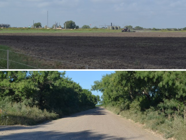
Zively's route of the Old San Antonio Road comes into La Salle County from the "four corners" intersection at its northeast corner. It crosses the Frio River and State Highway 97, then it turns to the west toward Cotulla. There are no modern roads along this segment, and most of it, being on private ranches and oil fields, is inaccessible to the public.
Map of the Old San Antonio Road in East La Salle County
[-]Collapse Map [+]Expand Map
Route Details
- Route lost from the Frio-La Salle County Line approximately 3 miles west of the Frio-McMullen County Line for approximately 23 miles to a point near the intersection of Brown Rd and Altito Rd.
Bottom: The Kings Highway crossed El Jardin Road (aka Natus Road) near this spot.
Where the Escorts Waited
The route of El Camino Real between San Antonio and the Rio Grande that V.N. Zively surveyed in 1915 was only used for a few decades in the late 1700s. At that time, Spain considered the Medina River to be the southern boundary of Texas, and San Antonio was the southernmost town in the state. The northernmost towns in the state of Coahuila were San Juan Bautista and Laredo, on the Rio Grande. The vast area in between San Antonio and the Rio Grande was completely unsettled.
In the early days of travel across Texas, it was typical to use native guides or escorts who knew where the roads were and knew where the best places were to cross creeks and rivers, find food and water, and camp overnight. Guides could also speak the languages of the natives and knew how to find their camps. Escorting travelers was a custom that the natives of Texas had followed long before Europeans arrived, but it was one that the Spaniards were glad to utilize, for it made their journeys easier, faster, and safer. This would have been especially important when traversing the wilderness between the Rio Grande and San Antonio.
When Zively marked the Kings Highway through northeastern La Salle County, he was following a diary made by Friar Juan Morfi on a journey from Presidio San Juan Bautista to San Antonio in 1778. Zively noted three streams that the road crossed in eastern La Salle County: Palo Blanco Creek, "Deep Gulch", and Las Esperanzas Creek. The latter stream is the only one that can be positively identified today, and it is the only one of the three mentioned in Morfi's diary. In Spanish, "esperanzar" is a verb meaning "to hope," and "las esperanzas" means "those who hope." A similar word, "esperar," means "to wait." Morfi wrote that Las Esperanzas Creek was given its name "because here the escort from Texas waits for that from Coahuila." The exact wording hints that the escorts did at least as much hoping as waiting, or perhaps the travelers hoped that their escorts would be there waiting for them.
Our analysis of Zively's sketch indicates that there is a very good likelihood that the historic crossing of Esperanza Creek, as it is now known, is the same one used today by a local road named Prince Road. Unfortunately, Prince Road is one of many local roads that are gated off and closed to the public today because of oil production in the area, so it is not possible to approach the historic crossing.
Zively placed the survey post for OSR Marker #100 about 2.5 miles south-southwest of Esperanza Creek. Moving on, the Kings Highway crossed the Frio River at a place Zively called "Lawhon Crossing" and where he placed OSR survey post "A." This location is unknown. There are no roads crossing the Frio River today in the vicinity of Zively's route, and the only references we have found to Lawhon Crossing or Lawhon Ford are discussions of Zively's survey. It may have been where present-day Hindes Road approaches the river.
The road followed the south or west bank of the Frio River for several miles. The survey post for OSR Marker #101 was left at the intersection of the Kings Highway and a road to Gardendale. Further on, where the river changes direction from southwest to southeast, the road continued south-southwest. It crossed present-day El Jardin Road, then it crossed Cibolo Creek, where Zively placed the survey post for OSR Marker #102. The road then continued on and intersected with the San Antonio, Uvalde, and Gulf Railroad. Zively noted that the road crossed the SAU&G between 2 and 3 miles1 west of Dull.
Two brothers, James and Andrew Dull, had large ranches in La Salle County in the late 1800s. A 1940 road map of La Salle County shows two places named Dull - perhaps because of the two brothers. One of those places is in the expected location, about 2.4 miles east of where Zively showed the Kings Highway crossing the SAU&G railroad. That railroad no longer exists, but its route is preserved by State Highway 97, which was built next to it. Consequently, this is the one waypoint on the Old San Antonio Road in eastern La Salle County that is both easy to match with Zively's survey and easily accessible - even if there is nothing actually there to look at. This waypoint is on Highway 97, 2.0 miles east of Farm-to-Market Road 469.
Separating from the Laredo Road
From San Antonio down to this point, the Kings Highway led to two destinations on the Rio Grande - Presidio San Juan Bautista, at the present-day town of Guerrero, Mexico, and Laredo. Eastern La Salle County is where this one road divided into two. The branch going to Laredo continued in the same south-southwesterly direction it had been on, while the other branch turned to the west, going through the present-day towns of Cotulla and Catarina to terminate at Presidio San Juan Bautista.
Zively had great difficulty dealing with the separation of the Laredo Road from the Presidio Road. This difficulty resulted in a gap in the sequence numbers of the Old San Antonio Road markers. Zively felt the need to explain this gap in a preface to his published sketches and notes:
I am well aware that a work of this kind should be entirely self-explanatory, but owing to adverse conditions and some very misleading data that was furnished me, I have been compelled to perpetrate a seeming inconsistency. There were only one hundred and twenty-three (123) posts or markers placed by me between the Sabine River and the Rio Grande,2 and the posts should have been numbered consecutively from beginning to end, but as will be seen the Post at Paso de Francia3 is numbered 128 while in LaSalle County ... there is a skip from Post No. 102 to Post No. 108, which occurred in this way: As I went South after putting up marker No. 102 I failed to find or notice the Presidio Road turning to the right and continued to follow and survey the Laredo Road to old Fort Ewell on the Nueces River. The map I had showed the King's Highway went in that direction and after crossing the Nueces at Fort Ewell turned almost to the West and crossed the I. & G. N. R. R. near Artesia Wells. When I reached Fort Ewell and made a thorough examination of the crossing there I became convinced that I had been misled and found that no road crossing the Nueces there had ever turned to the right in the direction of Artesia Wells from the fact that the country is so rough and broken that a Wolf could hardly get over it. I then spent several days in exploring the river for a crossing above Fort Ewell and at the Black Ranch, about midway between Fort Ewell and Cotulla, found an old ford from which a road led in a westerly direction - but the ford did not at all fit the description of the King's Highway crossing as contained in the Diary of Morfi relating a trip over this road in December 1778. Disheartened and almost discouraged, I decided to go by the most direct traveled route to Paso de Francia on the Rio Grande, pick up the road there, [and] follow it as described in the Morfi Diary back to its intersection with the road I had surveyed. This I did, but when I reached the Rio Grande I had to guess at the distance and put up the Marker 128, which I afterwards found to be incorrect by almost twenty-five miles. I then carefully surveyed and measured the old Road from Paso de Francia this way, putting up markers where necessary and numbering them backwards that is from Nos. 128 to 127, to 126 etc, until I intersected the Road previously surveyed at Post No. 108.
The place where the roads separated is approximately 2.3 miles south and 1.0 mile east of the intersection of SH 97 and FM 469. Zively placed the survey post for OSR Marker #108 here. As noted above, he came here after working his way back eastward from Presidio San Juan Bautista, so this was actually the last survey post that he placed and was presumably the last activity in his field work. As we follow Zively's sketches from post #108 on to the Rio Grande, we are actually reading them in reverse.
Zively placed the survey post for OSR Marker #109 just 1.3 miles southwest of post #108, in the vicinity of present-day Mumme Road and FM 469. The road then turned in an even more westerly direction. It intersected present-day Brown Road at or near the intersection of Altito Road.
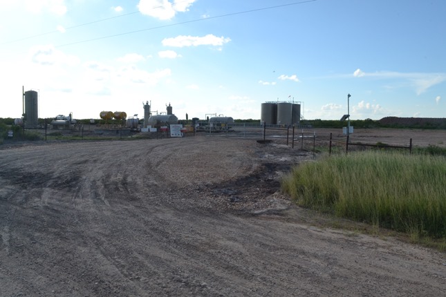
As with every other rural area in La Salle County, this segment of the Kings Highway is now being used for oil production.
Page last updated: July 20, 2015
1He wrote the numeral 2 followed by an illegible fraction.
2There were actually 124, including "Post A" in La Salle County.
3Paso de Francia is the name of the Rio Grande crossing at Presidio San Juan Bautista.
- Zively, V.N. - "Field Notes and Detail Map of the Kings Highway", 1916
- Carson, David - field notes observed and recorded in 2015