
Using Lidar to Map El Camino Real
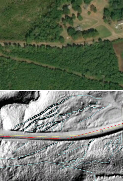
Lidar (or LIDAR) is the technology of using pulsed laser light to make three-dimensional representations of an area. When used as a surveying tool, lidar can produce high-resolution digital representations of terrain. Lidar surveying data can either include or exclude vegetation, depending on what one wishes to see. If vegetation is excluded, a Lidar image will show only the ground and any large, solid, stationary structures, objects, and bodies of water that are on it. The resolution of lidar is such that it reveals subtle evidence of human travel routes that have been unused for more than a hundred years.
In 2018, Darrell Hebert, an engineeer by profession, began using lidar data to analyze the route of El Camino Real. Hebert applies his extensive experience in lidar interpretation with georeferenced historical maps to find old homesites, trails, ruts, and swales that trace travel in early Texas. The set of articles below are a collaborative effort between Hebert and TexasCounties.net lead researcher David Carson to use lidar analysis to enhance our understanding of the Old San Antonio Road.
Readers who would like to contact Mr. Hebert about his lidar work can reach him at dbh (atsign) consolidated.net.
Articles
Articles on Using Lidar to Map El Camino Real
- San Augustine County - Zively's sketch of the OSR in San Augustine has problems. Can lidar solve them?
- East Bastrop County - Lidar analysis is applied to Zively's route between Paige and Bastrop.