This section analyzes the movements of the castaways on the Isla de Malhado, or Follet's Island, where two of the boats landed, and the area surrounding it. Follet's Island is one of the names for the peninsula west of Galveston Island and east of the city of Freeport.
Follet's Island was first settled in the late 1830s. A town and port named San Luis were built on the eastern tip of the peninsula. A ferry service operated between Follet's Island and Galveston up until the late 1800s. Development of the area was hampered in the 1800s both by hurricanes and by shifting sands that filled in the harbor and navigation channels. The peninsula was mostly unpopulated from around 1900 until the late 1960s, when the bridge over San Luis Pass to Galveston Island was completed. Follet's Island is still sparsely developed and is mainly a place where people go to vacation and fish. It is characterized by a beach all along its south side, tidal wetlands all along its north side, and a thin band of solid land along the middle. For a more thorough discussion of the geography and history of Follet's Island, including our analysis identifying it as the Isla de Malhado, see the article, "Identifying the Isla de Malhado."
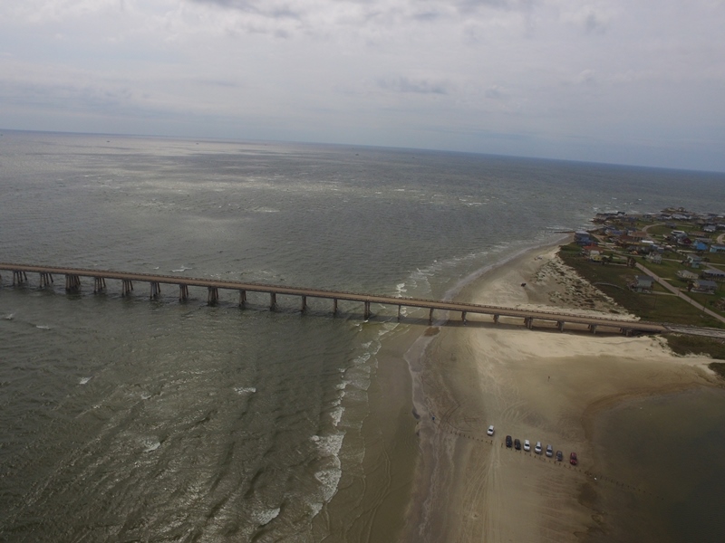
Figure 2. San Luis Pass at the east end of Follet's Island.
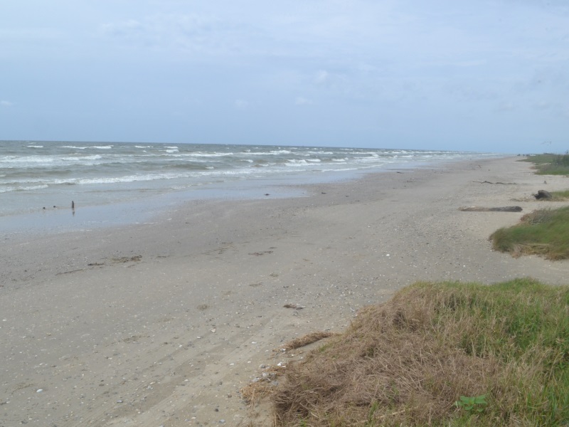
Figure 3. A beach on Follet's Island. Cabeza de Vaca and his comrades probably saw a scene very similar to this when they arrived in November 1528.
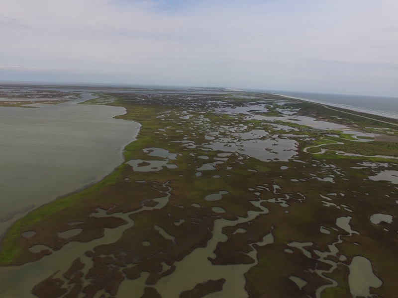
Figure 4. The north, or bay side of Follet's Island is filled with ponds and channels in which the natives fished and pulled roots.
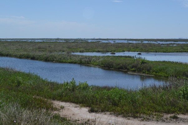
Figure 5. Lagoons at the Brazoria Wildlife Refuge.
The Malhado Castaways, November 1528 - April 1529
Cabeza de Vaca writes that the boat led by Alonso del Castillo and Andrés Dorantes landed on November 5, 1528.1 The location of this landing can be identified as San Luis Pass at the east end of Follet's Island. Cabeza de Vaca's boat landed two leagues, or about seven miles, west of there at around dawn the next day.2 After getting some help from the natives and recuperating for a few days, Cabeza de Vaca and his men attempted to relaunch their boat into the surf, but some big waves tumped it over. Three men died clinging to the boat, which was pulled down by the undertow. One of the men who died was Alonso de Solis, an officer of the expedition who went as King Charles's financial agent and inspector of mines. The names of the other two drowning victims were not recorded. Cabeza de Vaca writes that the next time the natives came to visit, there were two dead bodies on the beach. It is implied that these were two of the men who drowned, because no other deaths had been recorded up to that point.
Cabeza de Vaca asked the natives to take them to their village. At the village, his group learned about the existence of Castillo and Dorantes's group on the same island. Now joined together, the men attempted to repair their last boat, thinking it could carry at least some of them to the town of Pánuco on the Gulf coast of present-day Mexico, but instead it sank in the inlet of San Luis Pass "because of the wood worms and other problems."3 A man named Tavera died during this effort, but his death appears to have been unrelated to the actual launching and sinking of the boat.
With no more boats, the castaways realized that most of them were going to have to stay with the natives for at least part of the winter, but they still had hopes that a few of them could get to Pánuco to send help for everyone else. They knew this would require crossing some more rivers, inlets, and bays, so they chose four men "who were the strongest ones there" and who "were very great swimmers."4 One of the natives of Malhado went with them as a guide. If about 80 men landed on the Isla de Malhado, 4 men already died, and 4 more were sent away, then about 72 men remained after the strong swimmers left. Cabeza de Vaca specifically accounts for two nights spent on Malhado before sending the swimmers away, but he also uses the phrase "on other days" as if there were more.5 The earliest date they could have left is probably November 10. Based on information about their journey that is given elsewhere in the texts, they probably left at least one day later, November 11, 1528.
Cabeza de Vaca writes that there were three different native tribes that inhabited the Isla de Malhado and the area around it: the Capoques, the Han, and the De Chorruco. He placed the Capoques and Han on the island and the De Chorruco on the mainland across the bay, but he also stated that all of them migrated with the seasons, depending on where the food was the most plentiful. Winter arrived a few days after the strong swimmers left. The Joint Report, a record of the expedition co-authored by Cabeza de Vaca, Dorantes, and Castillo, states that "five or six days" after they left, people started to die. Starvation, exposure, and illness took a heavy toll on both the Spaniards and the natives. Some of the castaways stayed on Malhado; others, including Cabeza de Vaca, Castillo, and Dorantes, went to the mainland, and some went across the pass to Galveston Island. Those who stayed on Follet's Island probably inhabited the east end of the peninsula, where it is the widest. Cabeza de Vaca's observation that the Isla de Malhado was a half a league6 wide is more likely if measured on the east end, and his comment that it was almost two leagues from the mainland "where the water is the widest"7 also reflects the perspective of someone on the east end. The Treasure Island subdivision, which is the largest grouping of houses on the peninsula today, is now in this area.
The texts' discussions of the mainland adjacent to the Isla de Malhado indicate that it was abundant in oysters, mosquitos, swamps, and lagoons and devoid of trees. This could describe many places in coastal Brazoria and Galveston counties, but the area between Oyster Creek and Chocolate Bayou is especially fitting. This whole area has been preserved by the Brazoria Wildlife National Refuge.
Dorantes's Party - April 1529
The Joint Report states that the natives who Castillo and Dorantes stayed with migrated from the mainland back to the island at the end of March 1529. At this time, the Europeans began gathering together to leave. Dorantes seems to have assumed leadership of the group at this point. He found a total of fifteen men, including himself. There was one more who was alive, but Dorantes did not find out about him until later. This means that about 56 castaways died during the winter. The names of five who starved to death on the coast, even after resorting to cannibalism, are recorded: Sierra, Diego López, Corral, Palacios, and Gonzalo Ruiz. The rest are forever anonymous.
Of the fifteen survivors located, three were too ill to travel. Two of them were on the island. The other was Cabeza de Vaca, who was staying with some natives on a different part of the mainland from where Castillo and Dorantes had stayed. The Joint Report states that Castillo and Dorantes gave an Indian a fine fur robe they had acquired before reaching Texas as payment for taking them to see Cabeza de Vaca, but Cabeza de Vaca writes that he was unable to see them or leave with them because he was too sick. They also went to Galveston Island to pick up two people, described as "an Asturian cleric and a black man," who were there. The black man was almost certainly Dorantes's Moor slave, Estevanico, who was the only survivor known to be black. The natives then took the men across San Luis Pass and then "across another bay to get certain things which they gave the Spaniards."8 The text states that Dorantes and eleven other men began their walk to Pánuco on April 1, 1529. This may be only an estimate, but it is the only information we have to go on, so we treat it as if it were exact. Our estimate of where their journey began is indicated on the interactive map in Figure 1.
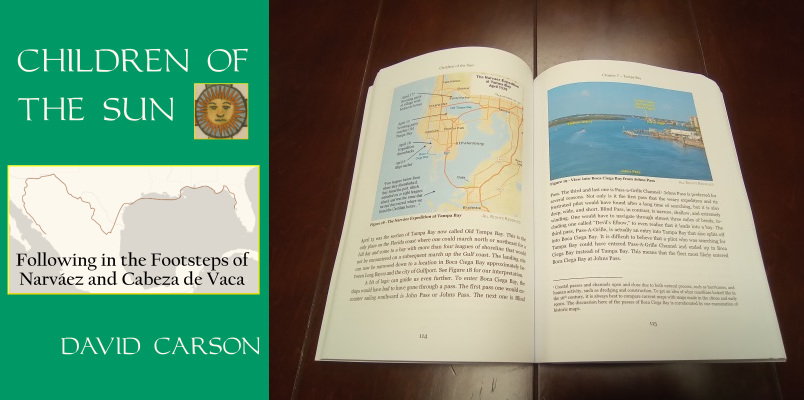
Order your copy of
Children of the Sun: Following in the Footsteps of Narváez and Cabeza de Vaca, by David Carson of TexasCounties.net, available in E-book and paperback formats.
The Joint Report contains some information about the route Dorantes's party took leaving Malhado. As noted above, the natives took the group over to the mainland to where Cabeza de Vaca was and to Galveston Island to collect Asturiano and Estevanico. They re-crossed San Luis Pass back to Malhado, and then crossed another bay to receive some gifts or supplies from the natives. After walking two leagues, they crossed a river, then three leagues further, they crossed another one. As explained below, the second river was, without question, the Brazos. This means the first river was three leagues, or approximately ten to eleven miles, from the Brazos. In 1898, University of Texas undergraduate students Brownie Ponton and Bates McFarland identified Oyster Creek as the first river. Since then, a majority of writers have followed suit, despite the fact that Oyster Creek is only about four miles - barely more than one league - from the Brazos. Even author Alex D. Krieger, whose analysis of Cabeza de Vaca's route is the one most widely used today, found that Oyster Creek was "about 9 miles" from the Brazos - which is more than double its actual distance - and concluded, "This appears quite suitable for the first river." Perhaps Krieger erred in using the distance from Oyster Creek to the man-made channel of the Brazos that was built in the 20th century, but Ponton and McFarland could not possibly have made that mistake.
A more likely candidate for the first "river" is Bastrop Bayou. At about ten miles from the natural channel of the Brazos, it is at the correct location. The biggest problem with this stream is the description given of it in the Joint Report as "a great river which was beginning to rise from floods and rains," which the men crossed on makeshift rafts "with great difficulty." The only way Bastrop Bayou would look like a "great river" today is in record flood conditions. The same difficulty exists for Oyster Creek, however; it is no larger than Bastrop Bayou. The first large, river-sized stream east of the Brazos is Chocolate Bayou, but it is about 5½ leagues away, which is too far. Out of Oyster Creek, Bastrop Bayou, and Chocolate Bayou, none of these three streams is a perfect fit with the narrative, but Bastrop Bayou comes the closest. This would place the group's starting location, conveniently, on the west side of Chocolate Bay, meaning that this could have been the last bay that the natives crossed to get supplies for their departing guests.

Order your copy of
The Account of Cabeza de Vaca: A Literal Translation with Analysis and Commentary, translated by David Carson of TexasCounties.net, available in E-book and paperback formats.
Cabeza de Vaca and Lope de Oviedo, April 1529 - Spring 1533
Sometime after Dorantes's party left, one of the sick men on the Isla de Malhado died. His name was Jerónimo de Alaniz, and he had been the expedition's scribe. Cabeza de Vaca and the other man, Lope de Oviedo, got better. Neither of them took the opportunity to leave after recovering, however. Cabeza de Vaca writes that he instead became an itinerant trader, making a living by buying and selling shells and other items. This occupation, he wrote, made him "very well-known among them." He further wrote that "Those who did not know me desired and took measures to see me because of my fame."9 He does not mention anything he saw or anyone he met during this time. For example, if he saw Galveston Bay, the largest bay he would have seen during the entire expedition, he never mentioned it. Some commentators have suggested that since one of his wares was red ochre die, he may have traveled into the redlands of east Texas. If he did go there, he never mentioned crossing the Trinity River or meeting the civilized and friendly Caddo tribes of the area. All he says about this time is that he traveled "forty or fifty leagues along the coast," which is certainly an overestimate, for that would have taken him almost to the Nueces River. The Joint Report writes, with somewhat more detail, that he "went farther up along the coast for a distance of forty leagues, and three times he passed what was a bay."10 This means he made it at least well into, or all the way through, Matagorda County. If he traveled that far, though, and traded with the various natives of the area, how did he avoid hearing any news about his comrades, or they of him, since he was so famous? Why, when he returned to this area in 1533, did the natives apparently not know him, and treat him so badly? There are so many questions about this part of Cabeza de Vaca's story that it is probably best not to even use it in interpreting his whereabouts.
While Cabeza de Vaca was going about wherever he went, Lope de Oviedo remained on the Isla de Malhado. Cabeza de Vaca writes that he "went over to the island every year" and tried to persuade Oviedo to leave with him, but "each year, he put me off, saying that we would go the following year."11 Cabeza de Vaca and Oviedo did finally leave together in the spring of 1533. If Cabeza de Vaca saw Oviedo once a year at about the same time every year, then Cabeza de Vaca made three unsuccessful attempts to extract him in the spring of 1530, 1531, and 1532 and succeeded on the fourth one. Cabeza de Vaca depicts Oviedo as being alone this whole time, which probably means Alaniz died before Cabeza de Vaca's first visit, if not pretty soon after Dorantes's party left.
The first stream west of Follet's Island is Oyster Creek, which is about four miles east of the Brazos River. As the previous section explains, many Cabeza de Vaca route interpreters, beginning with Brownie Ponton and Bates McFarland in 1898, identify Oyster Creek as the first "great river" that Dorantes's party crossed in April 1529, but this identification is flawed in that the Joint Report states that the first and second rivers were three leagues apart, while Oyster Creek and the Brazos, which is the second river, are barely more than one league apart. Nevertheless, Dorantes and his men had to have crossed Oyster Creek. Since they were coming down toward the coast from the mainland, they most likely crossed it several miles upstream of its mouth on the Gulf of Mexico, and it was not wide enough to cause them any notable difficulty.
The four strong swimmers who left the Isla de Malhado in November 1528 probably crossed Oyster Creek at or near its mouth, as did Cabeza de Vaca and Lope de Oviedo in 1533. Cabeza de Vaca did write that he took Oviedo across "four rivers that were on the coast." Up until the mid-20th century, Oyster Creek emptied directly into the Gulf of Mexico. The Gulf Intracoastal Waterway was constructed in the 1940s, using part of Oyster Creek's channel. The creek now flows into the waterway and dissipates in it, so its old channel between the waterway and the Gulf has partially filled in. A remnant of the old channel still exists west of Swan Lake, but the portion near the coast is now solid land that has been developed for beachfront housing. This area is on the outskirts of the town of Surfside Beach.
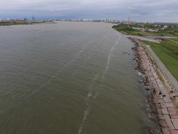
Figure 6. The old channel of the Brazos River, which was dammed in 1928 and is now a saltwater inlet. The photo looks "upstream" from near the mouth. The Dow Chemical plant at Freeport is seen in the background.
Leaving that place, whey went three leagues to another river which was swollen and flowing very powerfully. Its fury was such that sweet water poured for a great distance into the sea. - The Joint Report, Chapter 3.
The above description of Dorantes's party's journey leaves no doubt that they were at the Brazos River. This was the largest river on their journey and is the largest river on the Texas coast. It empties directly into the Gulf, not into a bay or behind a barrier island. Its identification as the second river Dorantes crossed is universally accepted.
The four strong swimmers who left the Isla de Malhado in November 1528 - whose names were Figueroa, Méndez, Álvaro Fernández, and Astudillo - were the first members of the Narváez Expedition who we can be sure saw the Brazos River. They would have reached it on their first day of travel, possibly on November 11, 1528. Depending on how much difficulty they had getting across, they may have camped close to its banks that night.
Dorantes, Castillo, and the other ten members of their party had to walk between 15 and 20 miles to reach the Brazos River, after spending part of that morning getting their group together. They had already crossed one river where they had to stop and build rafts on site, so they probably did not cross the Brazos until the second day of their journey, April 2. They were weak and tired, still undernourished from the previous winter, and had been reduced to eating seaweed and shellfish that were mostly shell. They had to make rafts once again to get across. The first group made it over without any problems, but when the second group tried to cross, their raft was carried out into the Gulf. Four men jumped off of it. Two of them swam to safety while two drowned. A fifth man clung to the raft and was carried "more than a league" out to sea. When he saw that the raft was no longer in the river current, he raised his body up and used it as a sail to catch the wind and return to shore. Cabeza de Vaca gives the names of all the members of Dorantes's party, but the texts lack exact information about where each man died. We know that men from this group named Estrada, Tostado, Chaves, Gutiérrez, and Benítez died on this part of the Texas coast. Two of these five were the ones who drowned at the Brazos River.
Another man, Francisco de León, joined Dorantes's party at the Brazos River, bringing their number up to eleven. The texts do not indicate where Leon had been up to this point. One might suppose that he was not located when Dorantes rounded up the castaways, but he subsequently learned from the natives that Dorantes and his party left, and he managed to catch up with them.
Cabeza de Vaca supposedly crossed the Brazos and then crossed back over again
twice between 1529 and 1532. He crossed it for the last time in the spring of 1533, with Lope de Oviedo.
The Brazos, the longest river in Texas, was re-discovered numerous times by later explorers, including Francisco Coronado, Robert La Salle, and Alonso de León. The first settlement at the mouth of the Brazos was Velasco, which was set up as a Mexican customs port on the east bank of the river in 1831. In a prelude to the Texas Revolution, the first bloodshed between Texas and Mexico occurred there on June 26, 1832. Texians Henry Smith and John Austin were attempting to bring a cannon out of the port to take it to Anahuac, where Texians were resisting the Mexican garrison commander. Domingo de Ugartechea, the commander at Velasco, attempted to stop the vessel carrying the cannon. Smith and Austin's men forced Ugartechea into a surrender after a battle in which about ten Texians and five Mexicans were killed.
After the battle of San Jacinto, Texas President David G. Burnet made Velasco the temporary capital of the republic, with Fort Velasco as the capital building. Mexican Generalissimo Santa Anna signed the treaties of Velasco, which ended the war for Texas independence, there on May 14, 1836.
After the revolution, Brazoria County became a leading producer of sugar and cotton. Numerous problems, however, including great difficulty navigating up the Brazos River, limited the prosperity of the port towns of Velasco and its sister on the west bank of the river, Quintana.
The discovery of the world's largest sulfur mine a few miles inland in 1912 was the beginning of the town of Freeport and the area's status as a chemical production region. In 1928, the U.S. Army Corps of Engineers solved the Brazos River navigation problem permanently by digging a new channel for the river, with a new mouth more than six miles down the coast. In 1940, Dow Chemical Company chose Freeport as its site to build a plant to extract magnesium from seawater. The Gulf Intracoastal Waterway was completed in 1949, providing a protected shipping channel all the way along the Gulf coast from Brownsville, Texas to northern Florida. These changes ushered in a new period of growth and prosperity. The population of Freeport grew from 4,100 in 1939 to 6,008 in 1952 and 11,619 in 1961. The Dow complex at Freeport is now the company's largest manufacturing site and produces 21 percent of its global output.
Freeport annexed the town of Velasco in 1957, but by then the town had moved north of its original location. The original townsite of "Old Velasco" was incorporated in 1975 as Surfside; it was renamed to Surfside Beach in 1988. The municipalities of Freeport, Surfside Beach, Quintana, and other towns in the vicinity are organized collectively as Brazosport, which has its own school district, chamber of commerce, and tourism board.
The Joint Report states that after Dorantes's party - now numbering eleven - crossed the second river, they "walked three or four leagues" to the next one.12 The third river is the only river out of the four they crossed that is not described in any way. The first one was "great" because of floods, the second one was "swollen and very powerful," and the fourth one was "great." The fact that the third river is the only one not so described implies that it was not especially large. There is only one candidate for this river: the San Bernard. This is one of Texas' smaller rivers, but it does empty directly into the Gulf - or it did before the Gulf Intracoastal Waterway was built. As with Oyster Creek, the waterway cuts down the force of the river, and its mouth has filled in and reopened more than once since the waterway was built. Judging from pre-waterway maps, its historic location was apparently close to 11 miles from the old mouth of the Brazos - slightly more than three leagues.
The coast of southwest Brazoria County is characterized by marshes and lagoons. It is virtually unpopulated. There are two large wildlife refuges here: the Justin Hurst Wildlife Management Area on the west side of the new Brazos River channel, and the San Bernard National Wildlife Refuge between the San Bernard River and the Brazoria-Matagorda County line. The San Bernard refuge also includes some land in coastal Matagorda County. In all, about 10 miles of the Narváez Expedition survivors' trail is in this preserve.
The first party of Narváez Expedition survivors to reach the San Bernard River was from the boat that was put in charge of Alonso Enríquez, the comptroller and third-highest-ranking officer on the expedition, behind Narváez and Cabeza de Vaca. The texts do not say whether Enríquez's boat landed at the river, or whether it landed further up the coast and then the men sailed it some distance before losing it there, but they do provide a hint: some of the men who were aboard Enríquez's boat believed that they had passed the River of Palms and Pánuco and needed to turn around and walk up the coast.13 Logic suggests that they would have known they did not walk right past Pánuco, so this means they believed their boat landed south of it. It never seemed to have occurred to Narváez, Cabeza de Vaca, Castillo, Dorantes, or any of the men in their boats that they may have landed south of Pánuco, so this implies that Enríquez's boat landed at a lower latitude than theirs.
Enríquez's boat could have landed at the San Bernard on the same day that Cabeza de Vaca's boat landed on the Isla de Malhado - November 6, 1528 - because Cabeza de Vaca's landed at dawn, and the two landing points are only 20 miles apart. Like the men who landed at Malhado, Enríquez's party would have taken at least a day or two to recuperate. Perhaps they began walking from the San Bernard River on November 9.
The next survivors to cross the San Bernard were the strong swimmers who left the Isla de Malhado after Castillo and Dorantes's boat sank. They could have made it this far on their second day of travel. November 12 is a reasonable estimate.
Based on the above information and deductions, the group of strong swimmers was anywhere from three to six days behind Enríquez's group at this point. We can assume from what occurs later that the swimmers did not have any contact with any other Narváez Expedition survivors until the following spring. Even if we apply the general principle that five men will usually travel faster than forty, it appears that Enríquez's party stayed ahead of the swimmers the whole way down the coast.
The San Bernard River is too far from San Luis Pass for Dorantes and his party to have reached it in one day. They were, at a minimum, on the second day of their journey, and more likely on the third, April 3.
Just like the Brazos, Cabeza de Vaca supposedly crossed the San Bernard River and crossed back over again twice between 1529 and 1532. He crossed it for the last time in 1533, with Lope De Oviedo.
There is very little information in the expedition chronicles concerning the movements of the boat commanded by Governor Pánfilo de Narváez, the leader of the expedition. We can be fairly confident that his boat was somewhere west of the Mississippi River on November 3 and that it was at Cavallo Pass in Matagorda County around mid-November. With a little bit of speculation and guesswork, we can estimate his traveling speed and position.
By our estimate, Narváez's boat crossed San Luis Pass and sailed down the length of Follet's Island on November 10. This was four days after Cabeza de Vaca's boat landed. It might have been the same date upon which Cabeza de Vaca's boat was lost and Solis and the other two men drowned. In any case, Cabeza de Vaca's and Castillo's men were certainly stranded on Follet's Island when Narváez sailed by, but they, sadly, failed to notice each other.
Narváez's boat, again by our estimate, would have been at or near the Brazos River by the end of November 10. The boat would have crossed the San Bernard River on November 11, perhaps about three days behind Comptroller Enríquez and his men and a day ahead of the four strong swimmers.
There is no proof that Narváez set foot in Brazoria County, but considering the length of the coastline, he almost certainly camped one night there, possibly November 10 and possibly at the Brazos, where fresh water was abundant and where the land is less marshy than on other parts of the coast. None of the other parties of the Narváez Expedition who passed through this area reported any contacts with natives, so it may have been totally uninhabited at that time.
| County | Castaways Who Visited | Dates | Castaways Who Died |
| Brazoria | 4 of the 5 boats, probably around 160 people | From Nov. 5, 1528 until spring of 1533 | Alonso de Solís ("the inspector") - drowned off Follet's Island
Jerónimo de Alaníz ("the scribe") - succumbed to illness on Follet's Island
Approximately 58 others on Follet's Island by causes including drowning, exposure, illness, exhaustion, and starvation. Names include Tavera, Sierra, Diego López, Corral, Palacios, and Gonzalo Ruíz.
Two members of Dorantes's party - drowned at the Brazos River |
By David Carson
Page last updated: March 3, 2017
