
The Old San Antonio Road Posts and Markers in East Madison County
The Old San Antonio Road Posts and Markers in East Madison County
Also see The Old San Antonio Road in East Madison CountyZively placed eight oak survey posts in Madison County and on its boundary with Leon County. Four of them were in the eastern part of the county shown on this map. The matching pink granite markers for all four have been moved. Two of them have been moved over a mile and are no longer on Zively's route. The other two markers were moved shorter distances and are still on Zively's route.
Map of the Old San Antonio Road in East Madison County
[-]Collapse Map [+]Expand Map
|
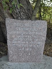
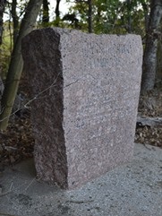
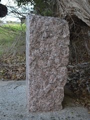
Marker #: 33
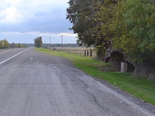
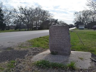
Coordinates: 31.063904, -95.716535 Location: SH 21 southwest of the Trinity River Relation to Road: 33 ft from northwest stripe, facing road, SE 140° Distance from post: 1.4 mi SW of post, 0.5 mi off of route Dimensions: 32" x 31" x 12" Setting: Concrete Other Markers/Signage: No Visibility: Medium Accessibility: Excellent This marker was originally placed at the Old San Antonio Road crossing of the Trinity River at Robbins' Ferry. Today, there is a state historical marker for Robbins' Ferry on Highway 21 near the crossing, but, inexplicably, the granite OSR marker is now 1.4 miles from the river. It is 0.4 miles southwest of County Road 248/Antioch Road. The marker can be found under a cluster of trees on the northwest side of the highway. It is set in concrete. There is an extra-wide shoulder that allows ample room to pull off of the highway and also makes the marker easier to spot. Highway 21 has a poor correlation in this area to Zively's surveyed route of the Old San Antonio Road. Consequently, Marker #33 is not only 1.4 miles from its original location on the Trinity River, but it is also about a half a mile northwest of the surveyed road. Observed on February 22, 2014. |
|
|
Marker #: 34
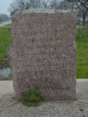
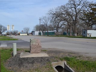
Coordinates: 31.024622, -95.752205 Location: Intersection of Highway 21 and OSR in Midway Relation to Road: 12 ft from west stripe of OSR, facing road, NE 60° Distance from post: 1.9 mi from post, off route Dimensions: 33" x 25" x 19" Setting: Concrete Other Markers/Signage: No Visibility: Medium Accessibility: Good This marker is at the intersection of State Highway 21 and State Highway OSR Highway in Midway. It is set in concrete over a culvert for a ditch. Since it is at the intersection, parking right next to the marker is not a good idea. One can park safely on the shoulder a few feet down the road. The marker blends into its surroundings somewhat, but it is easy to spot if you are looking for it. The lower half of this marker is rectangular, but the upper half is shaped irregularly. There are lichens on the top. Zively's route of the Old San Antonio Road went well north of Midway, not through it, so this marker is not at its original location. His notes indicate that he placed this marker "At John Crist League about 2 miles N10W from Midway". It would have been on or near present-day Farm-to-Market Road 242/Burns Road. Highway OSR was built between 1933 and 1936, so that may have been when the marker was moved here. Observed on March 22, 2014. |
|
|
Marker #: 35
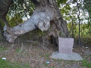
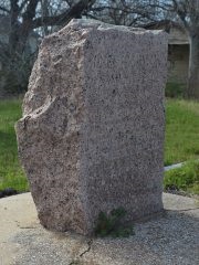
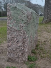
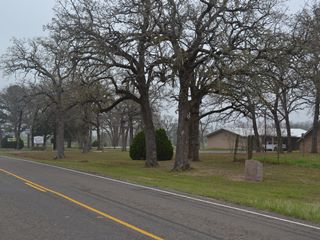
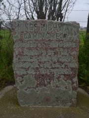
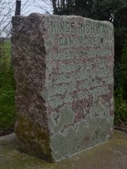
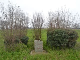
Coordinates: 31.059346, -95.827645 Location: State Highway OSR in Elwood Relation to Road: 21 ft from southwest stripe, facing road, N 20° Distance from post: 0.8 mi from post, on route Dimensions: 36" x 38" x 12" Setting: Grass Other Markers/Signage: Yes Visibility: High Accessibility: Good This marker is located in front of a pasture on the northwest side of Elwood Baptist Church on State Highway OSR. It is 5.3 miles northwest of Midway and 0.5 miles northwest of FM 2346. It is on the southwest side of the highway, which is the wrong side according to Zively's survey. The marker is on a shoulder of mowed grass under some shade trees. There are no signs pointing to the marker, but it is only sixty yards from a state historical marker for the church, which has a sign on the highway pointing to it. There is no pulloff, but the grass shoulder can be used for parking. The marker is wider than it is tall. There are lichens on most of the surfaces. Determining this marker's original location may be impossible due to a mistake or multiple mistakes on Zively's survey. The spot where his sketch shows the survey post is 0.8 miles northwest of its current location. This would put it on the southeast side of Cobb Creek. Zively noted that the "neat, thrifty little village" of Cobbs Creek Town was directly across the road from the survey post. Both Cobbs Creek Town and the survey post were depicted as exactly 5 miles from the survey post for Marker #36, which can be located easily. However, there are no records of a Cobbs Creek Town in Madison County, there are no records of a village at Cobb Creek, and there is no trace today of a village there a hundred years ago. Apparently, the village Zively was referring to was Elwood, which was the home of Cobb's Creek Baptist Church, and his mistake with the name of the town also caused him to mistakenly locate it at Cobb Creek. The above theory explains how Zively probably mistook Elwood for Cobbs Creek Town, but now what of the survey post for OSR Marker #35? If the town on Zively's sketch is shown a mile too far northwest, is the survey post also a mile off? In other words, did Zively show his post in the correct relation to the road, but not the town, or did he show it in the correct relation to the town, but not the road? This question cannot be answered with the information available. We do know that when the Texas Society Daughters of the American Revolution conducted their OSR marker rededication project between 1995 and 2001, this marker was at its current location next to Elwood Baptist Church. Since it is on the wrong side of the road, it was moved there some time after 1918, perhaps when State Highway OSR was constructed. The question is whether it was moved from Cobb Creek or merely from the other side of the road. As the sketch to the right shows, even though this marker has been moved, it does accurately mark Zively's route of the Old San Antonio Road. Observed on March 22, 2014. |
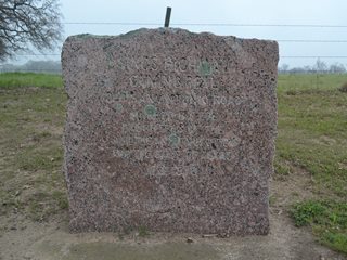
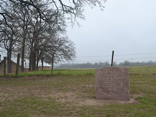  Above: OSR Marker #35 at Elwood Baptist Church, formerly Cobb's Creek Baptist Church. Below: V.N. Zively's sketch showing survey post #35 at "Cobbs Creek Town" on Cobb Creek. Bottom: Zively's survey post #35 location. 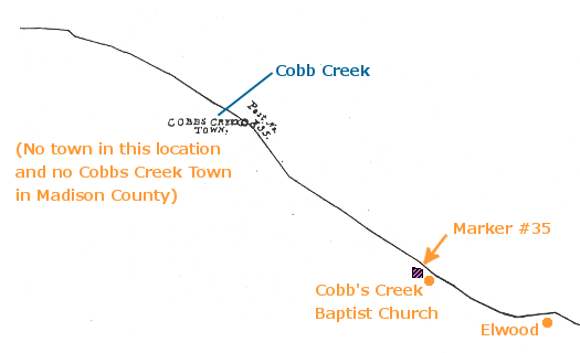 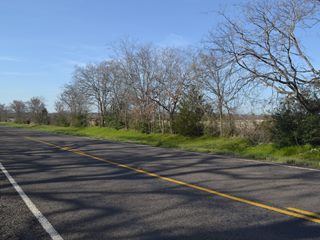
|
|
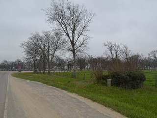
Marker #: 36
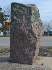
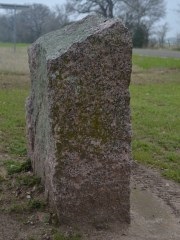
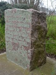
Coordinates: 31.083452, -95.926091 Location: Intersection of SH OSR and SH 75 Relation to Road: 31 ft from south stripe, facing road, N 350° Distance from post: 250 ft from post Dimensions: 31" x 23" x 15" Setting: Concrete with planted shrubs Other Markers/Signage: Yes Visibility: High Accessibility: Good to Fair This marker is on Highway OSR a short distance west of the intersection with Highway 75. It is in front of a pasture fence, set in concrete and surrounded by some planted crepe myrtle trees and shrubs. The marker and plants are surrounded by a rectangular concrete border, which is overgrown with weeds. The plants hide the marker from view from any direction except head-on, but the location is marked by a highway sign, so it is easy to find. There are no other historical markers or objects at the site. The face of the marker is covered with lichens, making it unreadable. There is a wide asphalt shoulder for parking, which will get you close to the marker, but if you want to get right up to it, you will have to cross a ditch. There is no culvert for crossing over, so if there is water in the ditch, your feet will get wet. Assuming Zively's survey is accurate, this marker was originally at the northwest corner of the intersection. It is now about 250 feet west of there, and has also been moved to the south side of Highway OSR. Observed on March 22, 2014. |
|
- Zively, V.N. - "Field Notes and Detail Map of the Kings Highway", 1916
- Carson, David - field notes observed and recorded in 2014