
The Old San Antonio Road Posts and Markers in Maverick County
The Old San Antonio Road Posts and Markers in Maverick County
Also see The Old San Antonio Road in Maverick County.Zively placed four oak survey posts for the Old San Antonio Road in Maverick County. All of them were placed on private property on large ranches. None of the matching granite markers have been located.
Map of the Old San Antonio Road in Maverick County
[-]Collapse Map [+]Expand Map
|
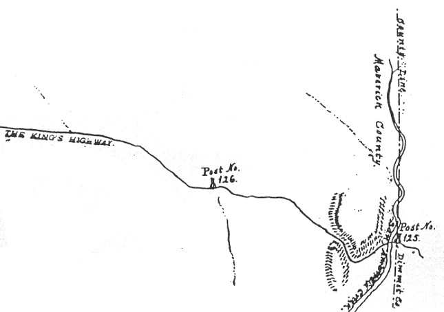
Marker #: 125
Coordinates: N/A Location: Not found Zively's sketch indicates that he placed the survey post for OSR Marker #125 on the east bank of San Ambrosia Creek, on the east side of some hills, and on the west side of the Dimmit-Maverick County line. Zively drew the county line too far west by 0.4 miles, meaning the marker, if it was placed on the east bank of San Ambrosia Creek, was actually 0.4 miles inside of Maverick County. The survey post location is on a large private ranch, very remote from any public road. The marker has never been documented. The Texas Society Daughters of the American Revolution did not document this marker during their 1995-2001 marker rededication project. The DAR's project web site contains numerous errors concerning Marker #125, incorrectly stating that it is (or was) on the San Pedro Ranch in Dimmit County, and giving the same geographic coordinates for it as for Marker #123 - coordindates which are incorrect for either marker. Observed on September 12, 2015. |
|
|
Marker #: 126
Coordinates: N/A Location: Not found This marker was originally placed approximately 2.0 miles west of the Dimmit-Maverick County line and about 1.5 miles west of San Ambrosia Creek. This is a remote location on private property. The marker has never been documented. The page in Zively's sketchbook that shows post #126 has several markings on it that could be taken to indicate unnamed creeks (see right). One of those markings is close to post #126. There are no creeks or creek beds in this vicinity, however. No other page in Zively's sketchbook has markings like this. These were probably made accidentally and were not meant to represent anything. Observed on September 12, 2015. |
|
|
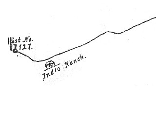
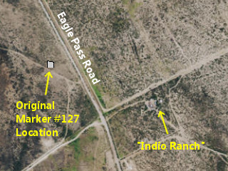
Marker #: 127 Coordinates: N/A Location: Not found This survey post for this marker was placed about 4.5 miles northeast of Paso de Francia on the Rio Grande. It was 0.4 miles northwest of a building Zively labeled "Indio Ranch." An old water tower and some new buildings still exist on that site. The survey post location is on a still-extant private ranch road less than a tenth of a mile west of Eagle Pass Road. The marker has never been documented. Observed on September 12, 2015. |
|
|
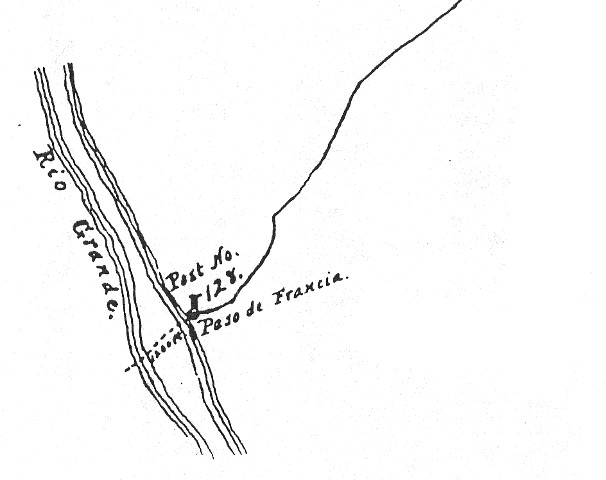
Marker #: 128 Coordinates: N/A Location: Not found This is the last marker on Zively's route of the Old San Antonio Road. It was placed at Paso de Francia, or "France Pass" on the Rio Grande, about 7 miles from present-day Guerrero, Coahuila. This area is private property. The closest public access to it on the American side is Eagle Pass Road, 4.5 miles away. The closest any Mexican road comes to the site is 1.5 miles. The granite marker has never been documented. Observed on September 12, 2015. |
 |
- Carson, David - field notes observed and recorded in 2015
- Zively, V.N. - "Field Notes and Detail Map of the Kings Highway", 1916